
Hiking Trails Near Me.
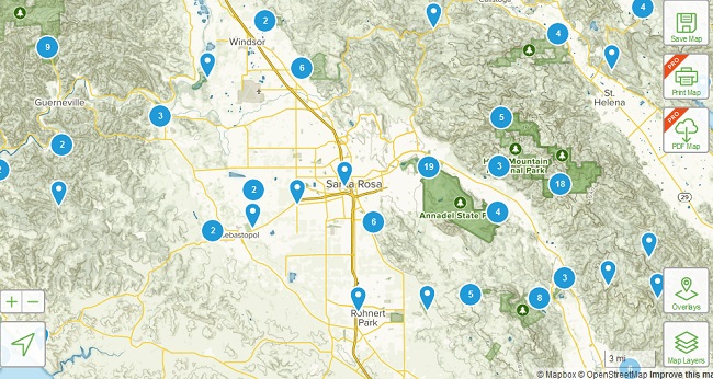
Find the best walking and hiking trails near me, by using our Trail Map below. Click on the map to see the starting point of the hiking trail and to read reviews by other hikers.
Hiking is one of the best, free things to do in nature, and both nature lovers and fitness lovers now flock to the this popular weekend activity.
However, if you are not familiar with the hiking trails in your area, then you will need a little help. Have a look at the map below, or read on about the best hiking trail apps, and you will soon be on your way.
Hiking Trails Near Me – Use the Map.
The map will automatically detect your location and suggest walking and hiking trails that are near your current location.
- Please note, that the cell phone GPS function must be enabled on your mobile phone for the Hiking Trails Map function to work.
- Click on a “Tree” icon or “Walking Man” icon on the map to reveal hiking reviews, address and directions.
- Click on “View Larger Map” to read further detailed hiking reviews, and more.
- The map is limited, so if you are a serious hiker, we recommend using one of the services below for finding detailed hikes near you.

You won’t need to travel far to find great hiking trails. Almost any city has a variety of trails starting right outside the city border.
Places to Hike Near Me – The Best Hiking Apps.
Here are some of the best hiking apps available for outdoor trip planning and navigation.
The best hiking app for finding hiking trails near me:
1. Wikiloc
Platforms: iOS, Android
Price: Basic Free, Premium $9.99 per year for navigation.
Wikiloc lets you find and discover the best trails near your location and follow them compass, live tracking and audio clues. The Hiking Trails database currently has 13,846,846 hikes worldwide, listed by Easy, Medium, Difficult. You can search the trails by location on their website without downloading the app at https://www.wikiloc.com/trails.
2. AllTrails
Platforms: iOS, Android
Price: Basic Free, Premium $29.99 per year.
AllTrails is one of the very best hiking apps available for finding hiking trails near me. Create your own hiking trails with GPS tracking, photos, text, then share them with others. The database has more than 100.000 hiking trails.
You can search the database without downloading the app by heading to https://www.alltrails.com/ and enter your city. Hiking trails are listed as Easy, Moderate or Difficult and other hikes have rated the hikes and left helpful tips. If you type in your city, a helpful map will show you the hiking trail paths starting points, along with the hiking details.
Alltrails has the largest database of hiking trails near you. Search the database and click on a hike, you like the look of.
Advanced Hiking Apps.
1. Gaia GPS
Platforms: iOS, Android
Price: Basic Free, Member $19.99, Premium $39.99
Gaia GPS is an outdoor navigation app with a rich catalogue of maps, topographical, satellite, road, and the NatGeo Trails Illustrated map series. It is possible to download a range of offline maps for off-grid access.
2. PeakVisor
Platforms: iOS, Android
Price: $5.99
PeakVisor is a amazing app that recognises the name of any mountain peak that may comes into view using your phone’s camera, location tracking and a 3D mountain panorama. It has a 3D compass and altimeter.
3. Cairn
Platforms: iOS, Android
Price: Basic Free, Premium $26.99 per year
Cairn is the “the ultimate hiking safety app”. Cairn shows you where others have found cell phone coverage on the trailr. This is useful if you need to make an emergency call.
4. Mountain Collector
Platforms: Android
Price: Free
Google Maps for peak hikers. Easily access mountain lists, locations, statistics, routes.
5. Maps 3D Pro
Platforms: iOS
Price: Basic $3.99, Premium $13.99
3D mapping app for visualising their upcoming hiking or cycling trips and easily interpret terrain features such as hills, ridges, trails and footpaths.
6. MapMyHike GPS Hiking
Platforms: iOS, Android
Price: Basic Free, Premium $29.99 per year
Record your hikes and log your food intake to track calories and nutritional content.
7. Weather Live
Platforms: iOS, Android
Price: Basic Free, Premium varies depending on package
The best weather app available.
8. Spyglass
Platforms: iOS, Android
Price: $7.99
Spyglass has a complete GPS toolkit with tracking features, a high-quality compass with speedometer, altimeter, astronomical object finder,, map overlays, a gyrocompass, a sextant, inclinometer, an angular calculator and more.
9. Viewranger
Platforms: iOS, Android
Price: Basic Free, Premium varies depending on package
ViewRanger lets hikers plan, navigate, record, share their outdoor adventures. With an advanced GPS navigation system.
–Hiking Trails Near Me – Find Hikes Near Me –
Remember, please avoid using proxys in order for the map function to work probably. If you cannot find the business or restaurant brand that you are looking for, then use the search function.
Use the Star Ratings system to rate brands/restaurants from 1 to 5 stars. The rating is an overall customer rating. Use the comment section to further detail your experiences.